Transform urban planning with precision 3D modeling and cutting-edge change detection technology that revolutionizes how you monitor, analyze, and implement development projects.
Why Us?
Integration
Seamlessly works with existing GIS systems, CAD platforms, and BIM workflows in your organization.
Efficiency
Reduce project timelines by 60% with automated change detection that eliminates manual comparison work.
Precision
Our technology delivers millimeter-level accuracy in urban change detection across all project stages.
Key Features
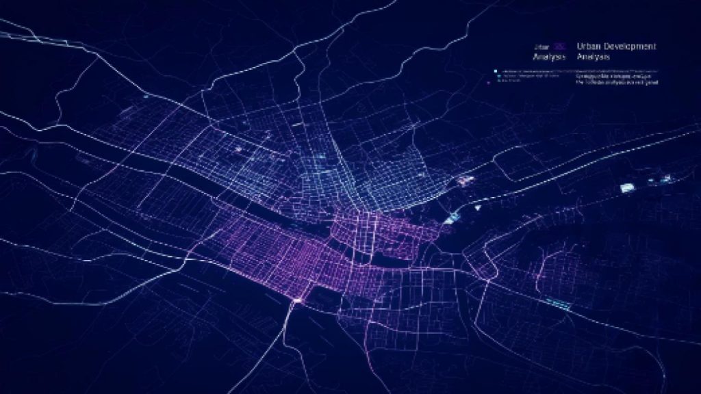
Change Analysis on Shapefiles
Extract meaningful insights from complex geospatial data using our advanced shapefile analysis tools that quantify and categorize changes for better decision-making.
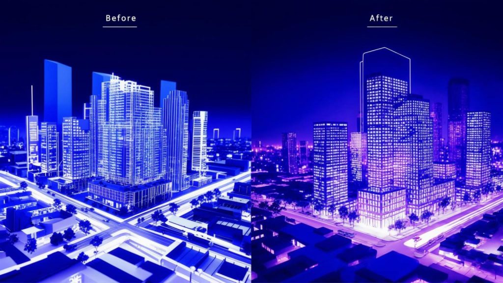
Change Detection on Images and Models
Automatically identify and highlight structural changes between time periods with AI-powered analysis that detects even the smallest modifications to the urban landscape.
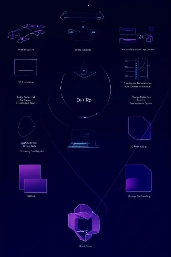
3D Modeling from Drone Images
Transform ordinary drone footage into detailed 3D models with our proprietary algorithms that capture every architectural detail and topographical feature with exceptional accuracy.
How It Works
Data Acquisition
Reduce project timelines by 60% with automated change detection that eliminates manual comparison work.
3D Reconstruction
Our proprietary algorithms process the raw data through photogrammetry and point cloud processing to create detailed 3D models with textures.
Analysis & Reporting
Receive comprehensive reports with quantified changes, compliance assessments, and actionable insights for decision-making.
Change Detection
Advanced AI compares current models with historical data to automatically identify and categorize structural and environmental changes.
Add Your Heading Text Here
Cloud Processing
Scalable processing architecture handling terabytes of spatial data
AI Analysis
Custom machine learning algorithms trained on millions of urban change scenarios
Advanced Drone Technology
High-precision UAVs equipped with multispectral sensors and RTK positioning
Geospatial Database
Enterprise-grade storage optimized for rapid retrieval of temporal 3D data